Queen Charlotte Track hiking guide
Queen Charlotte Track: Cruise & Self-Guided Hike from Picton
Can you day-hike the Queen Charlotte Track?
Yes. Most visitors don't walk the full 70 km multi-day track — a water taxi drops you at a section like Ship Cove or Furneaux Lodge for a 3-5 hour one-way walk with a cruise back, which is what the self-guided day cruise-and-hike combo covers. The full track takes 3-5 days with hut or lodge accommodation for those with more time.
A peninsula you can only properly see on foot or by boat
The Queen Charlotte Track traces the spine of a long, narrow peninsula between Queen Charlotte Sound and Kenepuru Sound, in the Marlborough Sounds at the top of the South Island. Unlike most well-known New Zealand walks, there’s no road access along most of its length — the peninsula’s coastline is so deeply indented with drowned river valleys that boats have always been the practical way to move people and goods through the Sounds, and the track exists as a walking alternative to that same water-based geography. That isolation is exactly what makes it worthwhile: forested ridgelines, quiet bays with DOC campsites and private lodges, and near-constant water views without another road in sight.
| Where | Marlborough Sounds, top of the South Island |
| Cost | Day walk from around NZD 150-220pp (cruise + walk) |
| Time needed | 4-6hrs for a day-walk section; 3-5 days for the full 70km track |
| Getting there | Cook Strait ferry to Picton (~3.5hrs), then water taxi |
| Best time | October-April; book ahead for summer (Dec-Feb) |
For Wellington-based visitors, it sits on the far side of the Cook Strait ferry crossing to Picton, roughly 3.5 hours by Interislander or Bluebridge, which makes the track a genuine South Island add-on rather than a simple day trip from the capital — something worth being upfront about before planning around it.
The full track vs a day walk
Walked end to end, the Queen Charlotte Track runs about 70 km from Ship Cove (Meretoto), where Captain Cook first anchored in New Zealand waters in 1770, to Anakiwa near Picton, typically broken into 3-5 days of walking with overnight stops at huts, campsites, or the private lodges scattered along the route (Punga Cove, Furneaux Lodge, Portage among them). Most independent trampers arrange a water taxi to Ship Cove at the start and either walk out to Anakiwa or arrange a pickup partway if time runs short.
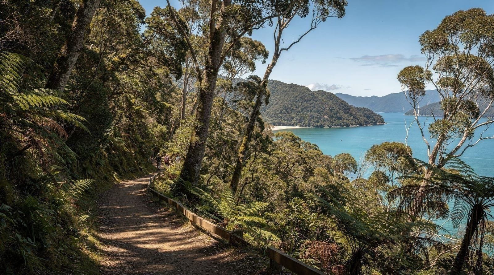
The far more common way most visitors experience the track, though, is as a single day walk. The Queen Charlotte Track cruise and self-guided hike departs Picton by boat, drops you at a chosen section — commonly the stretch between Ship Cove and Furneaux Lodge or Punga Cove, a well-formed 3-5 hour walk through regenerating native bush with sweeping Sound views — and picks you up later in the day by boat for the return to Picton. It’s genuinely one of the better ways to experience the Sounds without committing to multiple days of hut bookings and pack-carrying.
Ship Cove and its place in New Zealand history
Ship Cove, known in Māori as Meretoto, holds a genuinely significant place in New Zealand’s early contact history — Captain James Cook anchored here on five separate occasions across his three Pacific voyages between 1770 and 1777, using the sheltered cove to take on fresh water, repair his ships, and establish some of the earliest sustained contact between European explorers and Māori in the region. A memorial and interpretive panels at the cove mark this history in more depth than most walkers expect from what otherwise reads as a quiet forested bay, and it’s worth budgeting a few extra minutes at the start of the walk to read through it before setting off, rather than treating the cove as a simple boat drop-off point.
The wider Sound takes its European name, Queen Charlotte Sound, from Cook’s own naming after King George III’s wife, while the Sound’s Māori name, Tōtaranui, references the tōtara trees that once grew densely along its shores — much of the peninsula’s original tōtara forest was cleared for timber and farming in the 19th and early 20th centuries, and the beech and manuka forest walkers see today along most of the track is largely regenerating bush rather than untouched original growth, a detail that adds useful context to what can otherwise look like simply “native forest” without distinction.
Wildlife along the track
Native bird life along the track has benefited from pest-control efforts run by DOC and local conservation groups in parts of the peninsula, and walkers regularly hear or spot bellbird, tūī, fantail and weka along the well-forested sections, particularly early in the morning before boat traffic and other walkers pick up through the day. In the water alongside the track, especially near Ship Cove and the Sound’s outer reaches, common dolphins and occasionally orca pass through, visible from elevated sections of track with clear sightlines down to the water — no guarantee on any given walk, but a genuine possibility worth keeping an eye out for.
What a day walk actually covers
The Ship Cove to Furneaux Lodge or Punga Cove stretch, the most commonly walked day section, climbs steadily out of Ship Cove through beech and manuka forest before opening onto ridgeline sections with clear views down both sides of the peninsula to the water. It’s well-graded and clearly marked throughout, generally taking 4-6 hours depending on fitness and how often you stop for the views (which, honestly, you will — this isn’t a walk to rush). Historical markers along the Ship Cove end note Cook’s several visits to the Sound, a detail that adds useful context if you’re at all interested in early European contact history in New Zealand.
Shorter sections closer to Anakiwa suit walkers wanting 2-3 hours rather than a full day, though the trade-off is generally less dramatic scenery than the Ship Cove end. Whichever section you choose, sturdy walking shoes, water, sun protection and a windproof layer are worth carrying regardless of the forecast — weather in the Sounds can shift faster than it looks from the boat.
Multi-day itinerary: how it typically breaks down
Trampers walking the full track most often split it into four days rather than rushing it into three or stretching it to five, though all are possible depending on fitness and how many side detours you fancy.
| Day | Section | Approx. distance |
|---|---|---|
| 1 | Ship Cove to Furneaux Lodge or Camp Bay | 14-24km |
| 2 | Onward to Punga Cove or Portage | 10-13km |
| 3 | Torea Bay area, shorter walking day | 7-14km |
| 4 | Onward to Anakiwa | 12-23km |
Exact distances vary by which lodges or campsites you book, since side tracks and slightly different route options exist at several points. Booking accommodation ahead matters more than on most New Zealand walks, because the lodges and DOC huts along the way have limited capacity and no walk-up alternative given the peninsula’s lack of road access.
Should you do a day walk or the full track?
The honest answer depends on how much time you have on the far side of the ferry crossing, not on fitness alone — the day-walk sections are graded easy to moderate and don’t require multi-day hiking experience. A single day walk suits the vast majority of Wellington-based visitors, who are typically balancing the Sounds against a wider South Island itinerary and don’t have four or five spare days to dedicate to one track. The full multi-day track rewards trampers who specifically want a quieter, less-trafficked alternative to New Zealand’s Great Walks and who have the time to commit to hut or lodge bookings well in advance. If you’re unsure, a day walk is the lower-commitment way to sample the track’s character before deciding whether the multi-day version is worth planning a future trip around.
Getting there from Picton and Wellington
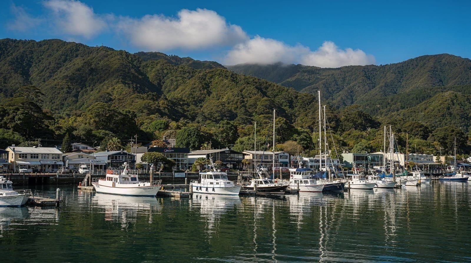
The water taxi or cruise element of the day walk departs directly from Picton’s town waterfront, a short walk from the ferry terminal if you’ve just arrived on the Interislander ferry from Wellington. For visitors overnighting in Picton or Blenheim rather than attempting the whole thing in a single day from Wellington, this is straightforward — book the walk for the following morning and you’ve got a full day’s buffer either side, similar to the logistics covered in our Marlborough Sounds cruise guide. Wildlife-focused travellers might also consider a stop at Kaikōura further south along the same route.
Attempting it as a genuine single day from Wellington and back is possible on paper but tight in practice: an early ferry over, the walk itself, an evening ferry back, with very little slack if anything runs late. Most visitors doing the Sounds properly build in at least one night in Picton or Blenheim, which also opens up Marlborough wine touring the following day rather than rushing straight back to the ferry terminal, and fits naturally into a week-long South Island trip via the ferry for travellers with more time.
Alternative ways to see the Sound without walking
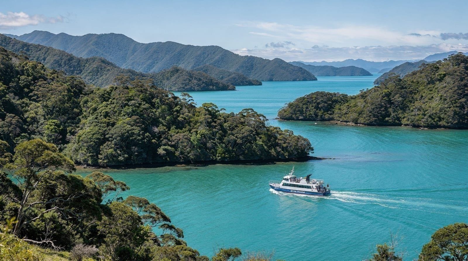
If a multi-hour walk isn’t for everyone in your group, the Picton shore excursion cruise around Queen Charlotte Sound covers much of the same scenery from the water without any walking required, stopping at points of interest around the Sound with commentary rather than a track underfoot. It’s a sensible option for travellers with limited mobility, young children, or simply a preference for a boat over a boot, and it pairs naturally with our broader Marlborough Sounds cruise guide if you’d rather spend the day on the water entirely.
Combining both — a cruise one way and a walked section the other — is also common among operators, and worth asking about directly when booking if you want a taste of the track without the full day’s walking commitment.
Huts, lodges and where to stay along the way
Multi-day walkers have a genuine choice between DOC huts and campsites (basic, bring your own food and sleeping gear, bookable through the Department of Conservation) and a string of privately run lodges — Punga Cove, Furneaux Lodge, Portage among the best known — offering proper beds, restaurants and bar service at the end of a walking day. Given the track’s isolation from road access, most lodges also run their own water taxi transfers for guests, which is worth factoring into planning if the DOC hut network’s basic facilities aren’t for you.
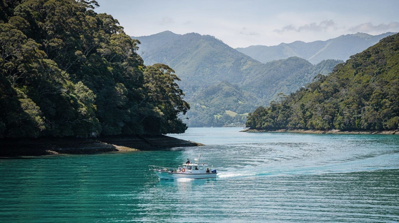
Water taxi operators based in Picton run scheduled and on-demand services along the length of the Sound, dropping walkers at track access points and lodge jetties alike, and most also handle luggage transfers between overnight stops for multi-day trampers who’d rather not carry a full pack the whole way.
Difficulty, fitness and what to pack
The well-formed day-walk sections suit any reasonably fit walker without technical hiking experience — expect graded gravel and dirt track, some sustained climbing on the ridgeline sections, and generally good footing in dry conditions. Wet weather turns some sections genuinely slippery, so proper grip on your footwear matters more than it might look from the trailhead. Carry more water than you think you’ll need, since shaded refill points are limited along most day-walk stretches, plus sun protection for exposed ridge sections and a packable rain layer, since Sounds weather can turn considerably faster than the forecast in central Wellington might suggest.
Best time of year to walk it
Late spring through autumn (October to April) offers the most reliable walking conditions and the warmest water if you fancy a swim at a beach stop along the way. Summer (December-February) is the busiest period, particularly around lodge bookings and water taxi capacity — book well ahead if travelling then. Shoulder-season visits in October-November or March-April tend to combine milder temperatures with noticeably fewer other walkers on the track, which suits travellers prioritising a quieter experience over guaranteed warm-water swimming.
Is it worth building into a Wellington trip?
For travellers with only a day or two to spare on the far side of the ferry crossing, yes — a single well-chosen day-walk section paired with the self-guided cruise-and-hike combo delivers a genuinely memorable slice of the Sounds without demanding multi-day logistics or hut bookings. It does mean committing to at least one night away from Wellington once you factor in the ferry crossing each way, so it suits itineraries already planning a Picton or Marlborough stopover rather than a rushed same-day round trip.
For trampers with more time, the full multi-day track is one of the more rewarding coastal walks in New Zealand precisely because so few people attempt it compared with the Great Walks, including the more heavily trafficked Abel Tasman Coast Track further west — expect genuine solitude on some stretches, which is either the appeal or the drawback depending on your taste for company on the trail. See also our guide to Interislander versus Bluebridge for choosing your ferry crossing before the track itself.
Families and less experienced walkers
The shorter sections near Anakiwa and Torea Bay, at 2-3 hours, suit families with older children and walkers who’d rather not commit to a full day on foot, with gentler grades and less sustained climbing than the Ship Cove end. Younger children generally manage these shorter stretches fine on a dry day with good footwear, though the ridgeline sections further along the track involve real climbing and drop-offs that aren’t ideal for very young kids or anyone uneasy with heights. If the group is mixed, the cruise-only option covered above lets less mobile travellers enjoy the Sound’s scenery while others walk a section and rejoin the boat later — worth discussing directly with the operator when booking.
Frequently asked questions about Queen Charlotte Track hiking guide
How long is the Queen Charlotte Track?
The full track runs about 70 km along the Queen Charlotte Sound peninsula from Ship Cove to Anakiwa, typically walked over 3-5 days. Day-walk sections range from a gentle 2-3 hour stroll to a solid 5-6 hour ridge-and-bay traverse, depending on which stretch a water taxi drops you at.Do you need a water taxi for the Queen Charlotte Track?
For most sections, yes — the track runs along a peninsula only accessible by water or by the track itself, so water taxis are the standard way to reach a starting point and get picked up afterwards. A handful of shorter stretches near Anakiwa and Torea Bay are reachable by road.Is the Queen Charlotte Track suitable for beginners?
The day-walk sections are graded easy to moderate and suit reasonably fit walkers without hiking experience, with well-formed tracks and clear signage throughout. The full multi-day track involves more sustained climbing and remote sections, and is better suited to walkers comfortable with several consecutive days on foot.How do you get to the Queen Charlotte Track from Wellington?
Take the Cook Strait ferry (Interislander or Bluebridge, about 3.5 hours) from Wellington to Picton, then a water taxi or the self-guided cruise-and-hike tour departs directly from Picton's waterfront. It's a full-day undertaking from Wellington and back if you're doing a day walk rather than staying overnight in the Sounds.When is the best time to walk the Queen Charlotte Track?
Late spring through autumn (October to April) offers the most reliable weather and warmest water for any swimming stops along the way. Summer (December-February) is busiest and driest; shoulder seasons see fewer other walkers and milder temperatures for the climbing sections.Can families with young children do the Queen Charlotte Track?
The shorter 2-3 hour sections near Anakiwa and Torea Bay suit families with older children well, with gentler grades than the Ship Cove end. Ridgeline sections further along involve real climbing and drop-offs that aren't ideal for very young children, so choose the section carefully based on your kids' ages and confidence on foot.Do you need to book huts or lodges in advance for the multi-day track?
Yes, strongly recommended. DOC huts and campsites are bookable through the Department of Conservation, and the private lodges (Punga Cove, Furneaux Lodge, Portage) have limited rooms with no road-access alternative if they're full. Book well ahead for summer (December-February) especially.
Top experiences
Bookable activities with verified prices and instant confirmation on GetYourGuide.